The Cinque Terre region, renowned for its breathtaking landscapes and rich cultural history, offers a network of trails that vary in difficulty, length, and scenery. This article provides a detailed guide to each trail, highlighting its starting and ending points, difficulty level, and interesting facts.
1. Termine – Crocettola (AV5T 1)
- Start: Il Termine
- End: Crocettola
- Length: 1.919 km
- Difficulty: Escursionistico (Hiking)
- Elevation Gain: 66 meters
- Duration: 50 minutes
- Interesting Facts: This trail offers a serene journey through dense Mediterranean flora, including pine woodlands. It intersects with other significant routes at Monte Crocettola, providing a glimpse into the region’s natural beauty
(Parco Nazionale 5 Terre) (Parks Online).
2. Riomaggiore – Sella La Croce (501, ex n. 01)
- Start: Riomaggiore
- End: Sella La Croce
- Length: 2.349 km
- Difficulty: Esperto (Expert)
- Elevation Gain: 583 meters
- Duration: 1 hour 30 minutes
- Interesting Facts: This historic mule track features steep ascents through vineyards and chestnut woods. The trail is marked by cultural landmarks, including the “Maduneta Palermi” votive niche, adding historical significance to the journey
(Parco Nazionale 5 Terre) (Parco Nazionale 5 Terre).
3. Tornate Groppo – Sella M. Galera (502, ex n. 02)
- Start: Piè di Fiesse, near Groppo
- End: Sella M. Galera
- Length: 2.101 km
- Difficulty: Esperto (Expert)
- Elevation Gain: 528 meters
- Duration: 1 hour 45 minutes
- Interesting Facts: This trail passes through historic vineyard terraces and mixed forests, offering spectacular views of the Ligurian Sea. Key highlights include the “Madonna del Piaggio” shrine, which adds a cultural touch to this scenic route
(Parco Nazionale 5 Terre) (Parco Nazionale 5 Terre).
4. Sant’Antonio – Schiara (504, ex n. 4)
- Start: Biassa
- End: Schiara
- Length: 2.521 km
- Difficulty: Esperto (Expert)
- Elevation Gain: 304 meters
- Duration: 2 hours
- Interesting Facts: The trail ascends from Biassa, passing the chapel of Sant’Antonio, and offers views of historical sites such as the Biassa Menhir, a monolith possibly dating back to pre-Christian times
(Parco Nazionale 5 Terre) (Parks Online).
5. Schiara – Innesto sent. 535 (504C)
- Start: Schiara
- End: Intersection with trail 535
- Length: 0.798 km
- Difficulty: Escursionistico (Hiking)
- Elevation Gain: 220 meters
- Duration: 50 minutes
- Interesting Facts: This short but steep trail provides a secluded hiking experience through abandoned vineyards and dense woodland, connecting Schiara with the main path 535
(Parco Nazionale 5 Terre).
6. Manarola – Bivio AV5T (Sella di Monte Marvede) (506, ex n. 6)
- Start: Manarola
- End: Sella di Monte Marvede
- Length: 4.031 km
- Difficulty: Escursionistico (Hiking)
- Elevation Gain: 635 meters
- Duration: 2 hours 40 minutes
- Interesting Facts: This trail ascends through olive groves and chestnut woods, offering spectacular coastal views. It’s a favorite for those looking to explore the agricultural heritage of Cinque Terre
(Parco Nazionale 5 Terre) (Parks Online).
7. Tornante Groppo – Innesto sent. 506 (506V, ex 6 VAR)
- Start: Groppo
- End: Intersection with trail 506
- Length: 1.226 km
- Difficulty: Escursionistico (Hiking)
- Elevation Gain: 238 meters
- Duration: 35 minutes
- Interesting Facts: This trail winds through vegetable gardens and olive groves, offering hikers a scenic shortcut or connection to the main trail network
(Parco Nazionale 5 Terre).
8. Vernazza – San Bernardino (507 A, ex n. 7)
- Start: Vernazza
- End: San Bernardino
- Length: 1.44 km
- Difficulty: Esperto (Expert)
- Elevation Gain: 588 meters
- Duration: 2 hours 20 minutes
- Interesting Facts: This trail offers stunning panoramic views as it ascends steeply through high-altitude vineyards. It is a challenging yet rewarding hike that connects the coastal village of Vernazza with the hamlet of San Bernardino
(Parco Nazionale 5 Terre) (Le Cinque Terre).
9. San Bernardino – Cigoletta (507 B, ex n. 7)
- Start: San Bernardino
- End: Cigoletta
- Length: 1.73 km
- Difficulty: Esperto (Expert)
- Elevation Gain: 226 meters
- Duration: 1 hour 30 minutes
- Interesting Facts: This trail navigates through dense forest and offers occasional views of the Guvano beach. It connects the Sanctuary of Nostra Signora delle Grazie with the Cigoletta pass
(Parco Nazionale 5 Terre).
10. Vernazza – Foce Drignana (508, ex n. 8)
- Start: Vernazza
- End: Foce Drignana
- Length: 3.547 km
- Difficulty: Escursionistico (Hiking)
- Elevation Gain: 477 meters
- Duration: 2 hours 15 minutes
- Interesting Facts: This trail follows a historic mule track and passes the Sanctuary of Nostra Signora di Reggio. The route is known for its scenic beauty and cultural heritage
(Le Cinque Terre) (Parco Nazionale 5 Terre).
11. Monterosso – Madonna di Soviore (509, ex n. 9)
- Start: Monterosso
- End: Madonna di Soviore
- Length: 2.467 km
- Difficulty: Escursionistico (Hiking)
- Elevation Gain: 468 meters
- Duration: 1 hour 45 minutes
- Interesting Facts: This trail features ancient sandstone paving and offers views of votive crosses and the Chapel of the Finding, where a sacred statue of the Virgin Mary was discovered in 740 AD
(Parco Nazionale 5 Terre) (Il vigneto 5 terre).
12. Campiglia – Punta Persico (528, ex n. 11)
- Start: Campiglia
- End: Punta Persico
- Length: 1.278 km
- Difficulty: Escursionistico (Hiking)
- Elevation Gain: 358 meters
- Duration: 40 minutes
- Interesting Facts: This steep trail descends through abandoned terraces to the secluded Persico Beach, offering a mix of history and natural beauty
(Le Cinque Terre) (Parco Nazionale 5 Terre).
13. C. Cimo – C. Persico (Via der Predao) (528C)
- Start: C. Cimo
- End: C. Persico
- Length: 0.367 km
- Difficulty: Escursionistico (Hiking)
- Elevation Gain: 46 meters
- Duration: 20 minutes
- Interesting Facts: This short trail offers a glimpse into the region’s quarrying past, with views of ancient sandstone quarries
(Le Cinque Terre).
14. Chioso – Navone (528V)
- Start: Chioso
- End: Navone
- Length: 0.481 km
- Difficulty: Escursionistico (Hiking)
- Elevation Gain: 102 meters
- Duration: 40 minutes
- Interesting Facts: This steep descent leads to Navone Beach, a quiet spot known for its rocky shoreline and tranquil atmosphere.
15. Telegrafo – Volastra (530)
- Start: Telegrafo
- End: Volastra
- Length: 9.719 km
- Difficulty: Turistico (Tourist)
- Elevation Gain: Moderate
- Duration: 2 hours 40 minutes
- Interesting Facts: This trail, also known as the “Strada dei Santuari” (Sanctuary Road), is relatively easy and offers gentle slopes through olive groves, vineyards, and mixed forests. The trail provides beautiful views of the sea and the surrounding hills, making it a peaceful option for those looking to explore the rural parts of Cinque Terre
(Le Cinque Terre) (Parco Nazionale 5 Terre).
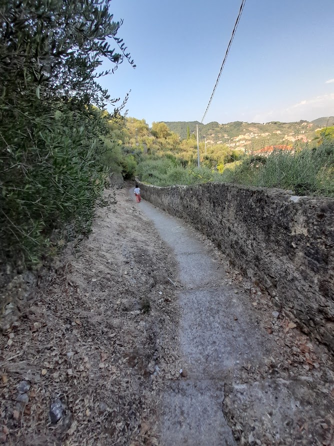
16. Bramapane – Cava Schiappacasse (Scala Santa) (530C)
- Start: Bivio Bramapane
- End: Cava Schiappacasse
- Length: 0.727 km
- Difficulty: Escursionistico (Hiking)
- Elevation Gain: 156 meters
- Duration: 15 minutes
- Interesting Facts: This short but steep trail follows the “Scala Santa,” a historic sandstone stairway used by pilgrims. The route offers stunning views of Riomaggiore and leads to the abandoned Schiappacasse quarry
(Le Cinque Terre).
17. Riomaggiore – Manarola (via Beccara) (531)
- Start: Riomaggiore
- End: Manarola
- Length: 1.47 km
- Difficulty: Esperto (Expert)
- Elevation Gain: 202 meters
- Duration: 1 hour
- Interesting Facts: This historic route, once the primary path between Riomaggiore and Manarola, is known for its steep climb involving around 600 steps. The trail offers spectacular views of the coastline, making it a challenging but rewarding alternative to the more famous Via dell’Amore
(Le Cinque Terre) (The Cinque Terre coast).
18. Parcheggio Corniolo SP 370 – Innesto 531 (531C)
- Start: Parcheggio Corniolo SP 370
- End: Intersection with trail 531
- Length: 0.404 km
- Difficulty: Escursionistico (Hiking)
- Elevation Gain: Modest
- Duration: 15 minutes
- Interesting Facts: This short connector trail provides convenient access to the main 531 trail, passing through cultivated fields and offering easy access for those parked near the provincial road
(Le Cinque Terre).
19. Costa Corniolo – Strada Santuari (532)
- Start: Costa Corniolo
- End: Strada Santuari
- Length: 1.209 km
- Difficulty: Escursionistico (Hiking)
- Elevation Gain: Modest
- Duration: 30 minutes
- Interesting Facts: This scenic trail connects the Via Beccara with the Sanctuary Road (530), winding through vineyards, pine forests, and Mediterranean scrub. It’s a peaceful route for those looking to explore the quieter parts of Cinque Terre
(Le Cinque Terre) (Parco Nazionale 5 Terre).
20. Groppo – Costa Corniolo (532C)
- Start: Groppo
- End: Costa Corniolo
- Length: 1.08 km
- Difficulty: Escursionistico (Hiking)
- Elevation Gain: 104 meters
- Duration: 30 minutes
- Interesting Facts: This trail connects Groppo with Costa Corniolo, providing a beautiful mix of natural landscapes including terraced vineyards and lush forests. It’s an ideal short hike for those seeking tranquility and natural beauty
(Le Cinque Terre) (Le Cinque Terre).
21. Riomaggiore (loc. Lupinau) – 530 Via dei Santuari (533)
- Start: Riomaggiore (loc. Lupinau)
- End: Via dei Santuari (530)
- Length: 1.39 km
- Difficulty: Escursionistico (Hiking)
- Elevation Gain: Modest
- Duration: 1 hour
- Interesting Facts: This trail ascends from Riomaggiore, passing through historic sites such as the ancient settlement of Cacinagora. It offers scenic views and a peaceful atmosphere, making it a great choice for those interested in the historical aspects of the region
(Parco Nazionale 5 Terre) (Le Cinque Terre).
22. Via Cacinagora (533V)
- Start: Main 533 trail
- End: Via dei Santuari (530)
- Length: 0.368 km
- Difficulty: Escursionistico (Hiking)
- Elevation Gain: Modest
- Duration: 30 minutes
- Interesting Facts: This trail provides a steep climb through the historic village of Cacinagora, considered the original settlement of Riomaggiore. The path is surrounded by woodland and offers a connection to the Via dei Santuari
(Le Cinque Terre) (Parco Nazionale 5 Terre).
23. Sant’Antonio – Fossola (534, ex n. 4C)
- Start: Sant’Antonio
- End: Fossola
- Length: 1.164 km
- Difficulty: Escursionistico (Hiking)
- Elevation Gain: 304 meters
- Duration: 45 minutes
- Interesting Facts: This picturesque trail descends from Sant’Antonio along a cobbled mule track. It passes through chestnut and pine forests before reaching Fossola, a hamlet with a rich history. The final section of the trail that once led to the sea is currently closed due to landslides
(Parco Nazionale 5 Terre) (Le Cinque Terre).
24. Campiglia – Monesteroli – SP 370 (535, ex n. 4b)
- Start: Campiglia
- End: SP 370
- Length: 3.756 km
- Difficulty: Escursionistico (Hiking)
- Elevation Gain: 199 meters
- Duration: 1 hour 30 minutes
- Interesting Facts: Known for its “Stairway to Heaven,” a steep staircase with over 1,200 steps leading to the sea, this trail offers a blend of natural beauty and historical significance. However, the section from Monesteroli to Fossola is currently impassable due to landslides
(Parco Nazionale 5 Terre) (Parks Online).
25. Monesteroli – Fossola – SP 370 (535)
- Start: Monesteroli
- End: Fossola – SP 370
- Length: 1.5 km
- Difficulty: Escursionistico (Hiking)
- Elevation Gain: 199 meters
- Duration: 1 hour 30 minutes
- Interesting Facts: This section of the trail offers stunning views of the coast and the surrounding terraces. It is a continuation of the previous trail but is currently closed due to landslides. The trail is challenging, with steep descents and uneven steps
(Le Cinque Terre)Telegrafo – Volastra (530) - Start: Telegrafo
- End: Volastra
- Length: 9.719 km
- Difficulty: Turistico (Tourist)
- Elevation Gain: Moderate
- Duration: 2 hours 40 minutes
- Interesting Facts: Known as the “Strada dei Santuari” (Sanctuary Road), this trail is relatively easy and offers gentle slopes through olive groves, vineyards, and mixed forests. The trail provides beautiful views of the sea and the surrounding hills, making it a peaceful option for those looking to explore the rural parts of Cinque Terre.
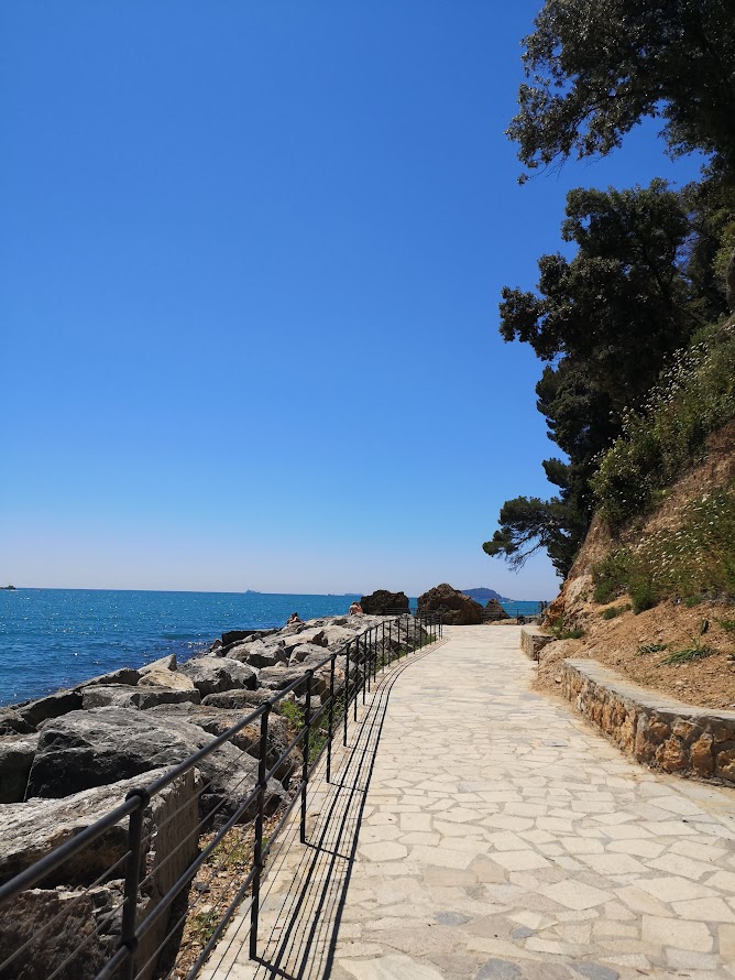
26. Via dell’Amore (592-1 SVA2)
- Start: Riomaggiore
- End: Manarola
- Length: 1.1 km
- Difficulty: Turistico (Tourist)
- Elevation Gain: Minimal
- Duration: 25 minutes
- Interesting Facts: Reopened in August 2024 after extensive restoration, the Via dell’Amore is one of the most iconic trails in the Cinque Terre. Known as the “Path of Love,” it offers breathtaking views of the coastline and is accessible to all, making it one of the most popular trails in the region
(Le Cinque Terre) (Cinque Terre).
27. Monterosso – Vernazza (592-4 SVA2)
- Start: Monterosso
- End: Vernazza
- Length: 3.7 km
- Difficulty: Esperto (Expert)
- Elevation Gain: 217 meters
- Duration: 2 hours
- Interesting Facts: This segment of the Blue Path is known for its steep and rugged terrain, offering some of the most iconic views of the Mediterranean. The trail passes through olive groves, vineyards, and offers panoramic views of both Monterosso and Vernazza
(Parco Nazionale 5 Terre) (The Cinque Terre coast).
28. Sentiero 598-3 (AV5T 1) Cigoletta – Il Termine
- Start: Cigoletta
- End: Il Termine
- Length: 7.1 km
- Difficulty: Escursionistico (Hiking)
- Elevation Gain: 329 meters
- Duration: 3 hours 15 minutes
- Interesting Facts: This trail is part of the Alta Via delle Cinque Terre, offering a quieter and more remote hiking experience. It traverses through dense forests and terraced landscapes, providing stunning views of the surrounding mountains and the sea
(Parco Nazionale 5 Terre) (Le Cinque Terre).
29. Sentiero 506: Manarola – Volastra – Corniglia
- Start: Manarola
- End: Corniglia
- Length: 5 km
- Difficulty: Escursionistico (Hiking)
- Elevation Gain: 335 meters
- Duration: 2 hours 30 minutes
- Interesting Facts: This trail is known for its panoramic views and passes through the village of Volastra, famous for its olive groves. The route includes steep climbs and offers breathtaking views of the coastline, vineyards, and the Mediterranean
(The Cinque Terre coast) (Le Cinque Terre) (Visit Cinque Terre).
30. Sentiero 598-1 (AV5T 1) Portovenere – Telegrafo
- Start: Portovenere
- End: Telegrafo
- Length: 4.725 km
- Difficulty: Escursionistico (Hiking)
- Elevation Gain: 254 meters
- Duration: 3 hours 20 minutes
- Interesting Facts: This trail, part of the Alta Via delle Cinque Terre, offers stunning views of the Gulf of Poets and the islands of Palmaria, Tino, and Tinetto. It passes through Mediterranean scrub, woodlands, and the historic village of Campiglia, making it a culturally rich and scenic hike
(Parco Nazionale 5 Terre) (Le Cinque Terre).
This comprehensive guide covers the most significant trails in Cinque Terre, offering detailed information on each route’s starting and ending points, difficulty, length, and unique features. Whether you’re a seasoned hiker or a casual walker, Cinque Terre’s trails provide a perfect blend of natural beauty, historical landmarks, and breathtaking views.
💡 Looking for more ideas? Discover the best:
✨ Planning a trip to Emilia Romagna? Your perfect Italian itinerary — just a click away
Discover more from Emilia Delizia
Subscribe to get the latest posts sent to your email.